A severe thunderstorm watch has been issued until 10 PM for the eastern Permian Basin, northern Edwards Plateau, Concho Valley, Big Country, Northwest Texas, West-Central Texas, and western North Texas. A few cities included are Del Rio, Fort Stockton, Kerrville, Kingsland, San Angelo, Big Spring, Snyder, Abilene, Vernon, Wichita Falls, Graham, and Mineral Wells.
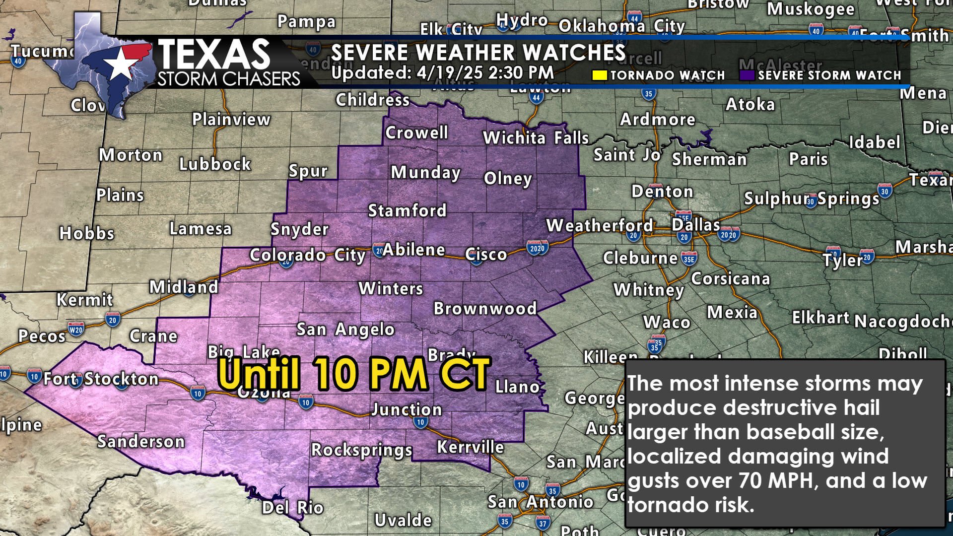
The most intense storms this afternoon and evening may produce destructive hail larger than the size of a baseball, damaging wind gusts over 70 MPH, and a low threat of a tornado. Today’s tornado threat may be slightly higher than last night, and we’ll be keeping a close eye on locations southeast of a cold front (if temperatures are in the 70s and 80s, you’re south of the cold front). The threat of a tornado may increase slightly closer to 6 PM.

Click the image/? for a full-screen animation. Simulated weather model radar this afternoon through 7 AM Sunday – with multiple rounds of strong to severe storms.
Scattered storms will continue developing in the aforementioned regions this afternoon. They’ll generally move northeast at 30 to 40 MPH. A few storms may develop closer to the western sections of the D/FW Metroplex and western North Texas near dinner time. If those storms develop, they’ll move more northerly.
Late tonight, another round of storms will fire up as the cold front begins moving more quickly to the east. That line of storms will move east across the aforementioned regions and into North and Central Texas in the pre-dawn hours on Sunday. Some of the late-night storms tonight may continue producing strong wind gusts and large hail. Storms will weaken tomorrow morning as they approach Interstate 35.
You can track the storms with our free interactive weather radar here on our website; and by watching our live weather stream here.