After a busy Saturday with severe weather, things are looking calmer today. However, a few strong to severe storms are still possible this afternoon and evening in the Ark-La-Tex, East Texas, and the Golden Triangle. While I don’t expect a repeat of yesterday evening’s severe weather, some storms could produce strong wind gusts, large hail, and heavy rain. A brief tornado cannot be ruled out in Northeast Texas, where a tornado watch is currently in effect. The threat of severe weather is expected to decrease by mid-evening.
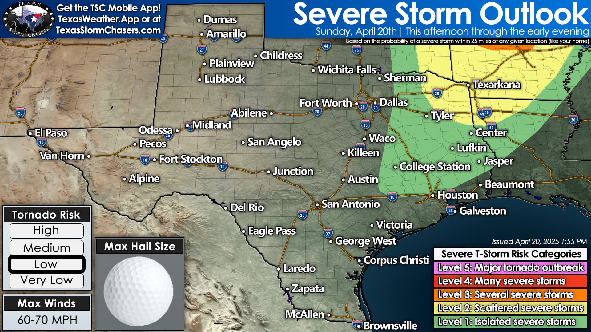
A more significant threat of severe storms is anticipated today in Arkansas and Missouri. Today’s scattered storms will be triggered by a slow-moving cold front across the eastern third of Texas.
This front will stall, allowing a moisture-rich air mass to persist in Southeast Texas and Far East Texas through Monday. Individual storms will move northeast, but tonight’s storms will likely “stall out” in Southeast Texas as the upper-level storm system moves away and steering currents weaken significantly.
These storms tonight into Monday may produce localized rain totals exceeding four inches, leading to the possibility of localized flooding. You can track the storms with our interactive weather radar here on our website, and in our free Texas Storm Chasers mobile app.