
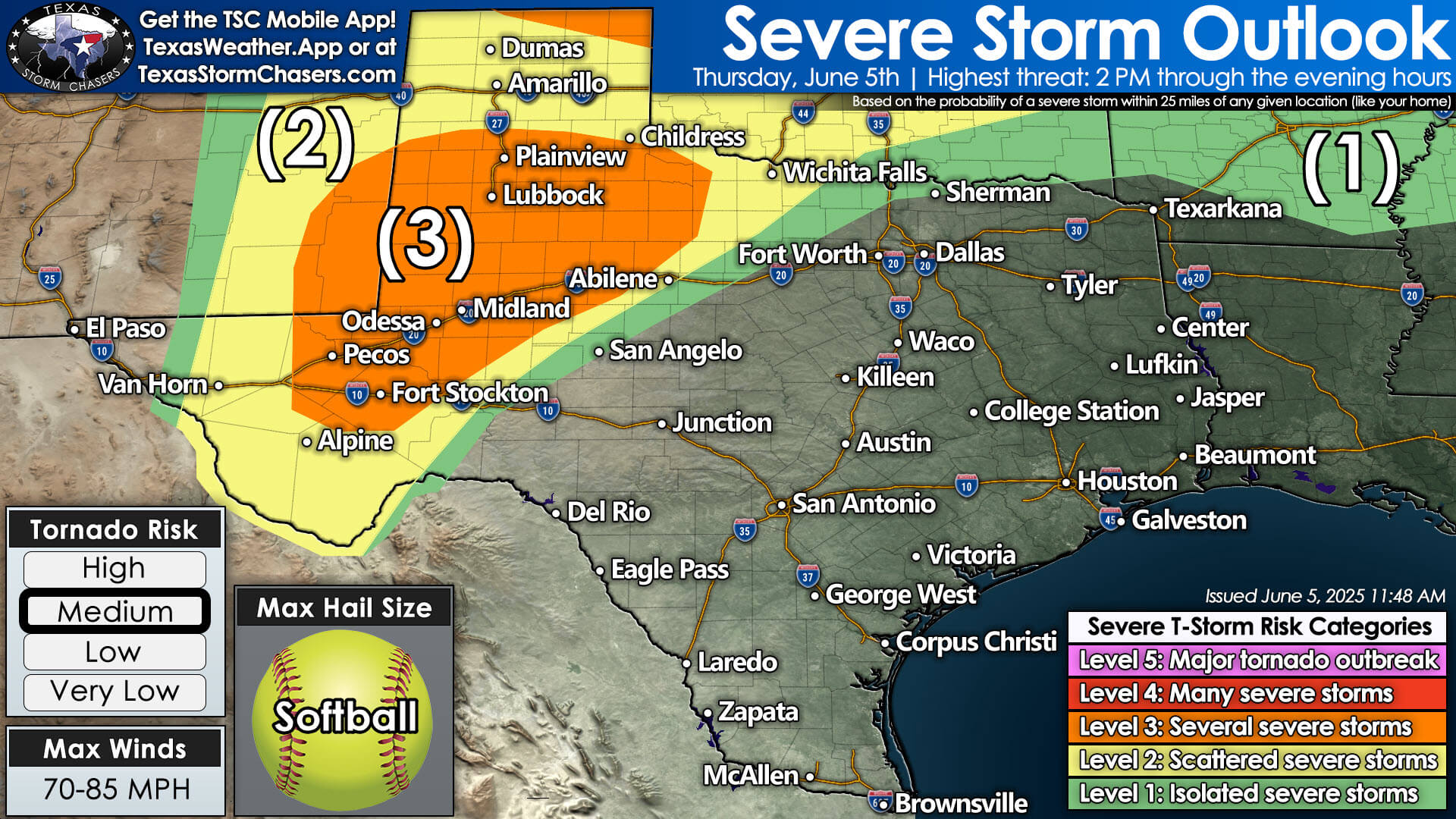
June 5th severe weather outlook: Areas from the Permian Basin to the Texas Panhandle face a Level 3 risk with potential for softball-size hail and 70–85 MPH winds.
Severe storms are expected this afternoon and evening across western Texas. The highest risk of severe storms will be in the Texas Panhandle, West Texas, and the Permian Basin. Unlike the last few days, tornadoes are anticipated to be a primary hazard today.
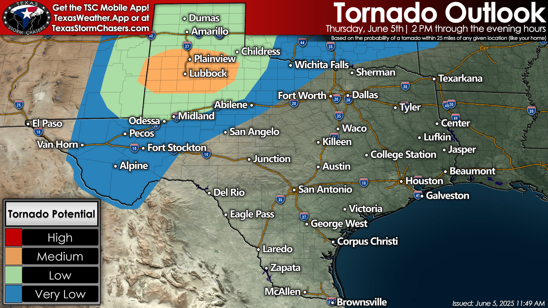
Tornado outlook for June 5th shows medium potential for tornadoes across parts of West Texas, particularly near Lubbock and Plainview.
We have an elevated risk of tornadoes across the South Plains, including the Lubbock area, due to enhanced low-level wind shear and expected favorable storm conditions. In addition to tornadoes, very large to giant hail and hurricane-force wind gusts over 80 MPH are possible. The most intense storms are forecasted to begin around 2-3 PM and continue through at least the mid-evening hours, moving generally to the east.
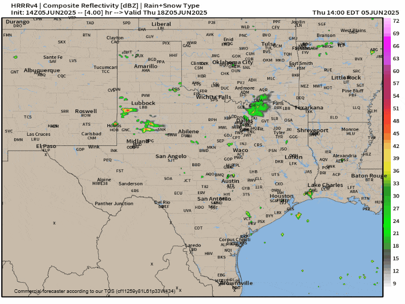
Simulated radar reflectivity from the HRRR model, showing storm development and movement across Texas on the afternoon of June 5, 2025.
Severe thunderstorm potential will persist daily through at least Sunday in the Panhandle, West Texas, Northwest Texas, Big Country, Texoma, and North Texas. The most intense storms could produce flooding rains, large hail, damaging winds, and frequent lightning. We’ll start in the mid-afternoon with scattered storms, evolving into clusters moving east into the late night hours. Rinse and repeat the next day! We’ll focus on the upcoming days after we get past today’s significant severe weather potential.
We will have live severe weather and tornado coverage beginning at 3 PM central time. You’ll be able to watch our live coverage here on our website, within our free Texas Storm Chasers mobile app, and on YouTube.