
A significant severe weather event is expected to unfold late Sunday afternoon through Sunday night across the Texas Panhandle, West Texas, Northwest Texas, Big Country, Texoma, North Texas, Northeast Texas, and the Ark-La-Tex. Destructive winds up to 100 MPH, baseball-sized hail, and a few tornadoes are anticipated. Widespread damage from destructive winds may occur over a large area, resulting in a possible derecho.

Severe storm risk map for Sunday, June 8th, 2025, highlights a possible derecho and widespread damaging wind threat across northern Texas, including Wichita Falls, Childress, and Sherman.
Initial thunderstorm activity will develop during the mid-afternoon hours in the Texas Panhandle and West Texas. Very large hail, localized damaging winds, and a tornado may happen.
Those storms will move east and quickly grow into a large cluster that will begin moving southeast into Northwest Texas by early evening. Once storms grow upscale into a cluster or squall line, along with storms in Oklahoma, widespread damaging wind gusts, embedded tornadoes, and hail are expected.
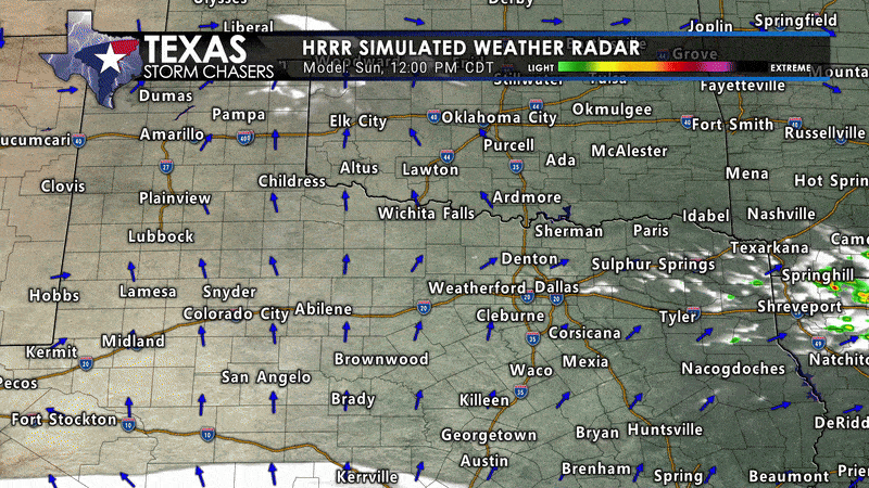
Click image for full animation. Simulated HRRR radar animation for Sunday, June 8th, 2025, showing forecast storm development, wind inflow, and potential areas of severe thunderstorm activity across Texas and surrounding states.
Activity will race southeast at highway speeds tomorrow night across Texoma, North Texas, and Northeast Texas. There is significant concern that a widespread, damaging wind event may occur – with the potential for power outages, tree damage, and considerable impacts. Embedded tornadoes and large hail are also likely.
Storms will move into Arkansas and Louisiana a few hours after midnight Monday.