
Significant severe thunderstorms are likely to occur late this afternoon through tonight across the Texas Panhandle, West Texas, Northwest Texas, Big Country, Texoma, North Texas, Northeast Texas, and the Ark-La-Tex.
Multiple waves of storms are possible. The most intense storms will produce destructive, hurricane-force wind gusts exceeding 100 miles per hour, large hail measuring four to five inches in diameter, and a few tornadoes.
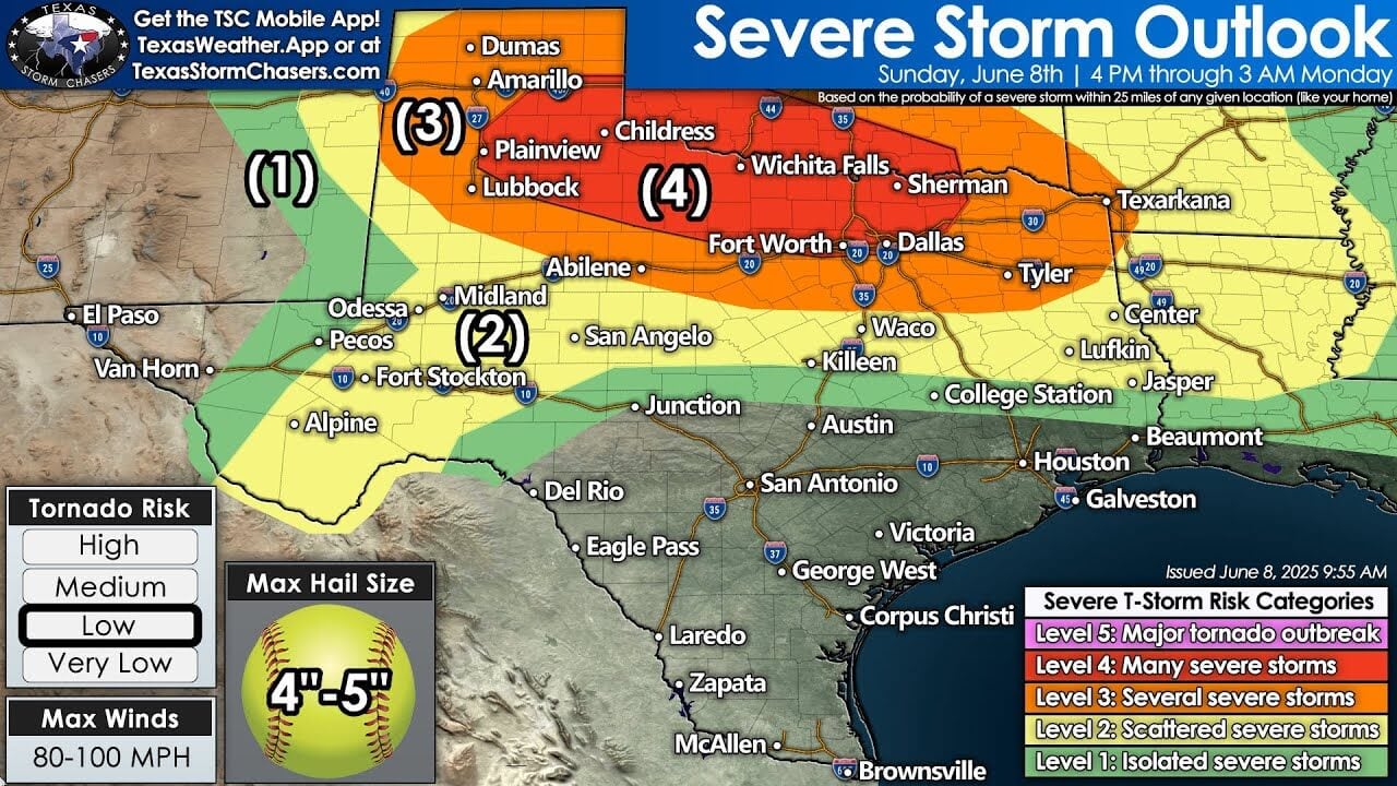
Sunday, June 8th severe weather outlook for Texas highlights a Level 4 risk across northern regions including Wichita Falls and Childress, with possible 80–100 MPH winds and giant 4–5″ hail.
Widespread damaging wind gusts and wind-driven hail are major concerns. We encourage everyone not to park their vehicles under trees this evening and to be prepared to move to a safe location if dangerous storms approach their area.
We’re projecting 4 PM as the starting time for the first intense storms of the day to develop in the Texas Panhandle and West Texas. We may also see storms develop further east in Northwest Texas and Southwestern Oklahoma.
As those storms initially form, they’ll be capable of producing large hail, damaging winds, and tornadoes. It won’t take long for storms to mature into clusters or line segments that move southeast at highway speeds.
The strongest lines will be those capable of producing destructive winds of 80 to 100 miles per hour, with an ongoing risk of very large hail and spin-up tornadoes. We could see multiple rounds in areas like Texoma and North Texas this evening, including the D/FW Metroplex. Storms will be moving rapidly from northwest to southeast/east.
Activity will push into Northeast Texas and the Ark-La-Tex late this evening and overnight before exiting into Louisiana and Arkansas early Monday morning. Heavy rain and localized flash flooding are also hazards with tonight’s storms across the northern third of Texas.
We’ll have live severe weather coverage starting at 5 PM today, and we’ll be here through the evening keeping you updated on the dangerous storms expected across the northern third of Texas.