
The flash flood threat continues to increase across portions of Central Texas as we head through tonight into Thursday morning. The National Weather Service has issued a Moderate Risk for excessive rainfall, now extending from Waco, Killeen, and Austin southward into the San Antonio metro area, based on the latest observational trends and high-resolution model guidance.
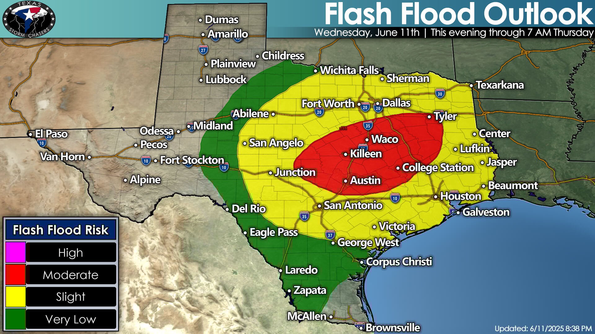
Flash flood outlook update for Wednesday evening, June 11th, 2025, highlights continued moderate flood risk across Central Texas with storms expected to persist overnight into Thursday morning.
Multiple rounds of thunderstorms are expected to develop and train across the same areas tonight, creating a dangerous flash flood setup. The 0Z run of the High-Resolution Rapid Refresh (HRRR) model shows an increasingly concerning scenario unfolding:
Updated Timeline (Based on 0Z HRRR Simulated Reflectivity)
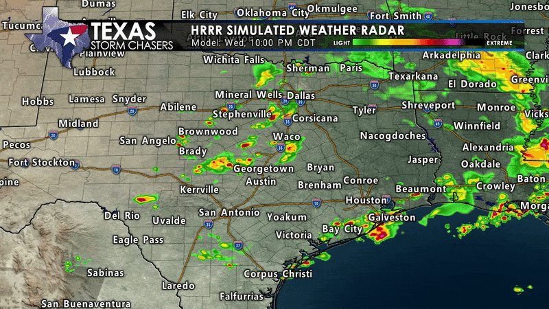
Click IMG to view animation. HRRR simulated radar loop for Wednesday night, June 11th into early Thursday, June 12th, showing continued storms across Central Texas with ongoing flash flood risk.
7 PM – 10 PM:
Scattered thunderstorms initiate across the Concho Valley, Edwards Plateau, and parts of Central Texas. Storms may initially be isolated but capable of heavy rainfall, hail, and gusty winds. A brief tornado can’t be ruled out.
10 PM – 1 AM:
Storms consolidate and move southeast into the I-35 corridor, impacting areas from Waco to Austin and San Antonio. Storms begin to train, dumping multiple rounds of torrential rain.
1 AM – 5 AM:
The flash flood risk peaks overnight as heavy rain bands repeatedly impact the Hill Country and the I-35 corridor. The HRRR suggests rainfall rates may exceed 1-3 inches per hour, with total accumulations of 5-8 inches possible in localized areas.
5 AM – 8 AM:
Heavy rainfall shifts southeast toward the coastal plain, with continued flooding possible near Houston, Victoria, and Southeast Texas before activity begins to diminish.
Key Concerns
Rapid flash flooding overnight, especially across urban areas, low-water crossings, and flood-prone regions.
Isolated totals of 5-8 inches of rain possible.
Saturated soils from recent rains will exacerbate runoff and flash flood risk.
Residents across Central Texas are urged to monitor forecasts and have multiple ways to receive warnings overnight. Never attempt to drive through flooded roadways.
Stay tuned for continued updates as this dangerous overnight rain event unfolds. You can keep up with the latest with our live weather stream here.