
Scattered thunderstorms are expected this afternoon and evening across western Texas as the monsoon begins.

Sunday’s outlook features a Level 1 risk for isolated severe storms across far West Texas and the Texas Panhandle with a very low tornado threat.
Be prepared for locally heavy rain, dangerous cloud-to-ground lightning, damaging wind gusts, blowing dust, and lightning-induced grass fires. The primary time frame will be 3 PM through 11 PM for stronger storms. Some activity will continue into the morning hours on Monday across the Big Bend, Davis Mountains, and Borderland.

Click the image for a full animation. HRRR model radar loop shows scattered showers and isolated storms developing over Texas on Sunday, June 22, 2025.
Today, Texas will experience seasonably warm temperatures, although it will be a few degrees cooler than in recent days. This afternoon, high temperatures are expected to range from the upper 80s to the upper 90s. Additionally, high humidity levels will contribute to continued muggy conditions.
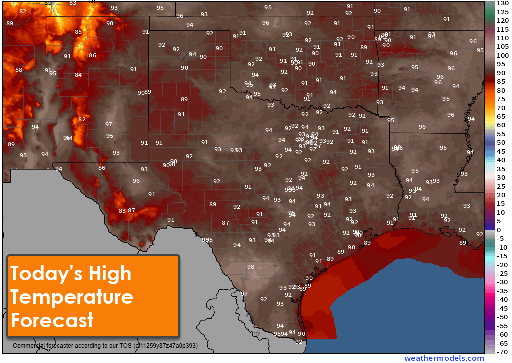
Sunday’s forecast calls for widespread heat across the Southern Plains, with high temperatures reaching the 90s and even triple digits in some areas.
You can keep an eye on the sky with the free Texas Storm Chasers mobile app; and by visiting our interactive weather radar here on our website.