
Isolated to scattered showers and thunderstorms are expected across several regions of Texas through Friday, due to monsoonal moisture in the west and tropical moisture in the east. A key factor in our ongoing pop-up rain chances is the absence of an upper-level high-pressure system sitting over Texas. That might change for the eastern half of the state by this time next week.
Today and Friday will see increased cloud cover and at least isolated pop-up showers and storms in Texas. Most people won’t see rain, and those who do likely won’t see it last more than an hour or two. The same applies this weekend, though in a more limited fashion. Cloud cover will be somewhat more widespread, helping temperatures stay a bit cooler.
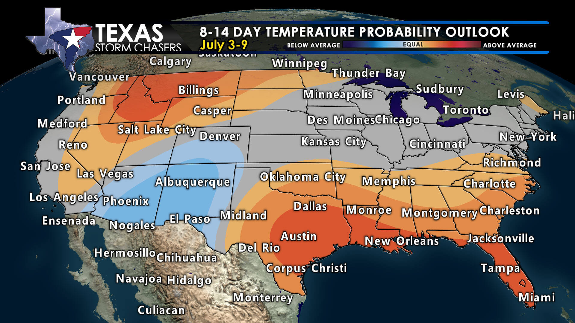
Above-average temperatures are likely across most of Texas and the Southeast U.S. through early July, while the Southwest may stay cooler than normal.
As we move into the second half of next week, it looks like temperatures will finally rise above average, with triple digits and warmer overnight lows, especially across the eastern two-thirds of Texas.
Expect localized damaging wind gusts, dangerous cloud-to-ground lightning, and heavy rain with pop-up storms over the next couple of days. Gusty winds and lightning can occur ten to twenty miles away from where rain is falling, so when thunder roars, go indoors. These gusty winds may also be sudden and not linked to rainfall, posing a significant hazard to those on lakes.