
Some short-range forecast guidance indicates a growing risk for locally heavy rain across parts of South-Central Texas overnight into Saturday morning. Rainfall amounts of 3 to 5 inches will be possible in localized areas, which may result in isolated flooding concerns — especially in low-lying or poor-drainage locations.
The highest potential for heavier rain appears to be in areas near and west of San Antonio, including portions of Uvalde, Medina, Frio, and surrounding counties. Stay weather-aware and monitor official updates if you are in the affected region.
Live Radar:
https://texasstormchasers.com/radar
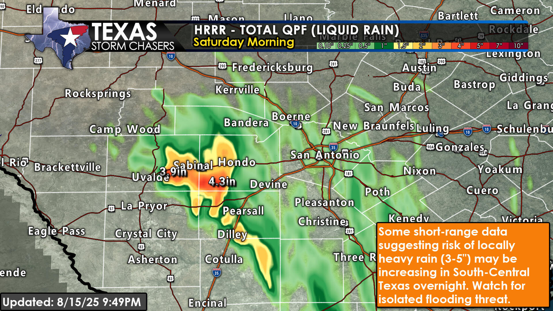
Texas Storm Chasers graphic showing HRRR forecast rainfall totals through Saturday morning. The heaviest rain, in the 3–5 inch range, is focused between Uvalde, Hondo, and Pearsall in South-Central Texas. Surrounding areas show lighter rainfall amounts. An orange text box notes the risk of locally heavy rain and isolated flooding overnight.