
Summer heat and humidity are hanging on across much of Texas, but changes are on the way. Active weather is set to return later this week and into the weekend, bringing scattered storms and the potential for locally heavy rainfall.
Today (Tuesday), most Texans will stay hot and dry, though a few isolated showers or pop-up storms could develop across the eastern half of the state and near the Gulf Coast. The Panhandle and parts of West Texas may also see some showers this evening, with the Borderland having the best shot at rainfall.
By Wednesday and Thursday, storm chances increase across the Panhandle and West Texas. Some storms could be strong, producing gusty winds, lightning, and brief heavy downpours. The Weather Prediction Center highlights the potential for locally heavy rain, raising the risk for isolated flash flooding in some areas.
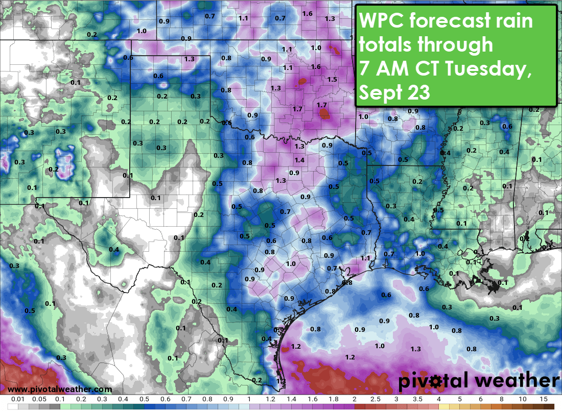
Forecast rainfall totals from the Weather Prediction Center show the potential for one inch or more in parts of Texas by early next week.
Heading into the weekend, the upper-level pattern begins to shift. Scattered thunderstorms will remain possible in the Panhandle and West Texas, and by early next week, rain chances may expand into Central, South, and East Texas. If the forecast holds, parts of the I-35 and I-45 corridors could pick up healthy rainfall totals early next week.
Despite the rain chances, much of Texas will still deal with hot and muggy weather through the week. High temperatures will remain in the 90s for most of the state, with slightly cooler readings possible in the Panhandle by late week. Long-range outlooks from the Climate Prediction Center keep above-average temperatures in place for much of Texas into late September.
Stay tuned as we track this shift in the weather pattern. For interactive radar and daily video updates, visit TexasStormChasers.com or download the free Texas Storm Chasers mobile app.