
Scattered severe thunderstorms are expected to develop this afternoon and evening across portions of Texas as a late-summer weather system moves through the region. The main area of concern includes Texoma, North Texas, Northwest Texas, and parts of West Central Texas.
The primary timeframe for storms will be from about 3 PM through midnight. Storms are expected to initiate near or just north of the Red River this afternoon before moving south-southeast into North Texas and West Central Texas. Additional development south of the Red River is also possible.
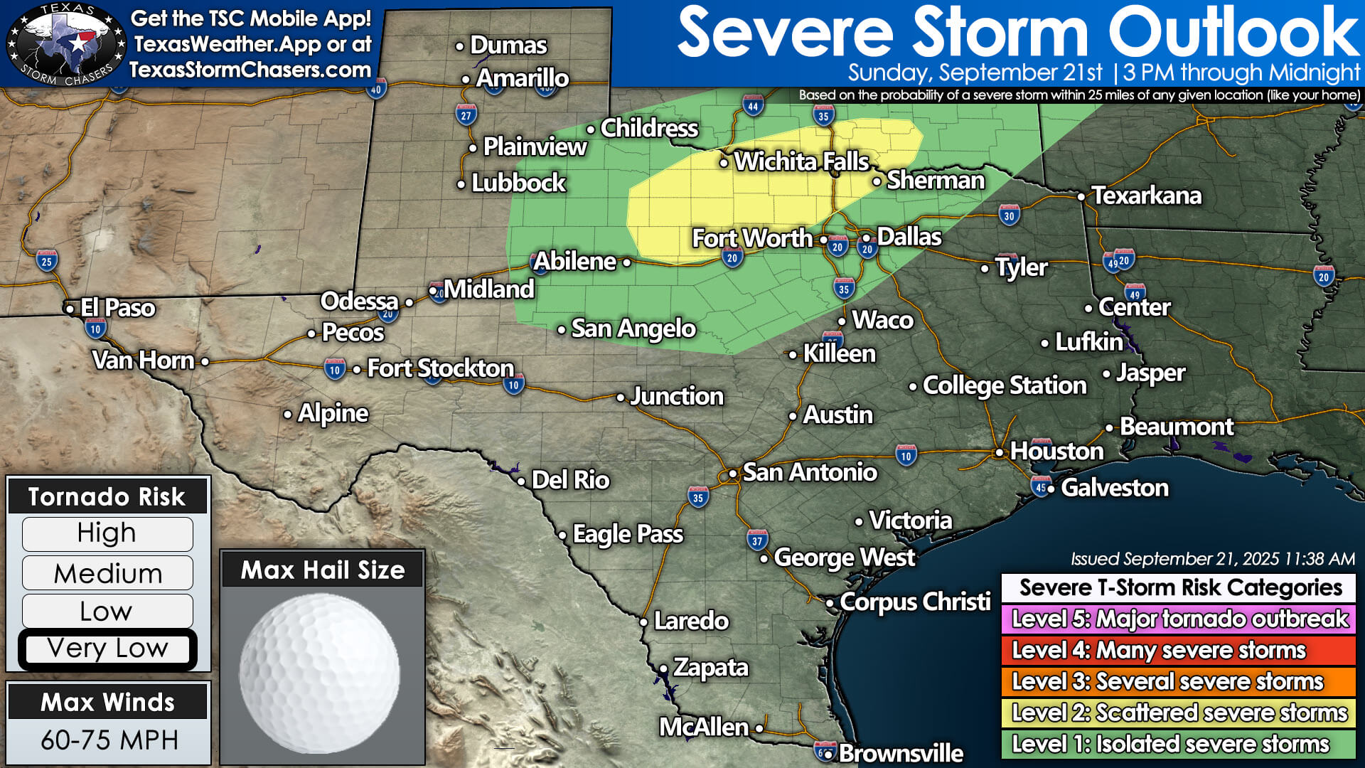
Scattered severe storms possible across North Texas, including the DFW Metroplex, with large hail and damaging winds the main threats.
The strongest storms may be capable of producing large hail, damaging wind gusts over 60 MPH, and localized flooding from heavy rainfall. Dangerous cloud-to-ground lightning will accompany any storms. While the tornado risk is very low, it is not completely zero, especially with the more intense storms early in the evening.
Residents in the DFW Metroplex should be aware that storms could arrive between 8 PM and 11 PM. While weakening is likely as they move into the metro, storms may still be rowdy and could disrupt evening plans and air travel.
Elsewhere, isolated pop-up thunderstorms are expected along the Texas Gulf Coast today. These storms are not expected to be severe but may still produce gusty winds, heavy downpours, and frequent lightning.
Flooding is also a concern across portions of the Panhandle and Far West Texas overnight, especially in areas that receive repeated rounds of heavy rain.
As always, we’ll be keeping a close eye on the radar this afternoon and evening. You can track storms in real-time with the free Texas Storm Chasers mobile app or by visiting our interactive weather radar at texasstormchasers.com/radar.
Stay weather aware and remember: when thunder roars, get indoors.