
A cold front is pushing into Texas today, September 23, bringing the risk of severe storms, large hail, damaging winds, and flash flooding across North and East Texas. This could be one of the most widespread severe weather events of early fall.
Severe Weather Setup
The Storm Prediction Center highlights North Texas, Texoma, and Northeast Texas for the greatest risk of severe weather late Tuesday into early Wednesday. Storms may fire as early as mid-afternoon, but the most widespread and intense activity is expected this evening and overnight.
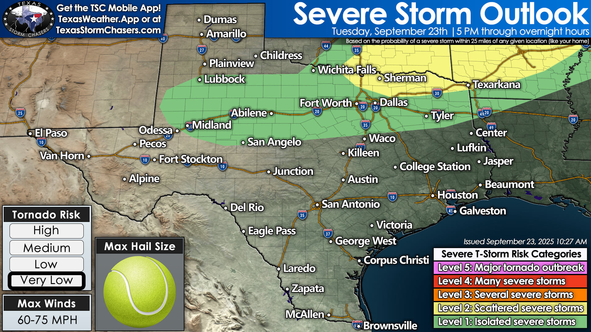
SPC outlook shows severe storm potential this evening into tonight across North Texas and Texoma.
Hazards include large hail (possibly larger than golf balls), damaging wind gusts over 70 mph, very heavy rainfall, and dangerous cloud-to-ground lightning. While the tornado threat is low, it is not zero—especially closer to the Red River.
Flash Flooding Concern
One of today’s biggest threats will be heavy rain. Northeast Texas, East Texas, and parts of North Texas could see several inches of rainfall overnight. Localized totals exceeding five inches may trigger flash flooding, street flooding, and rapid rises on creeks and streams.
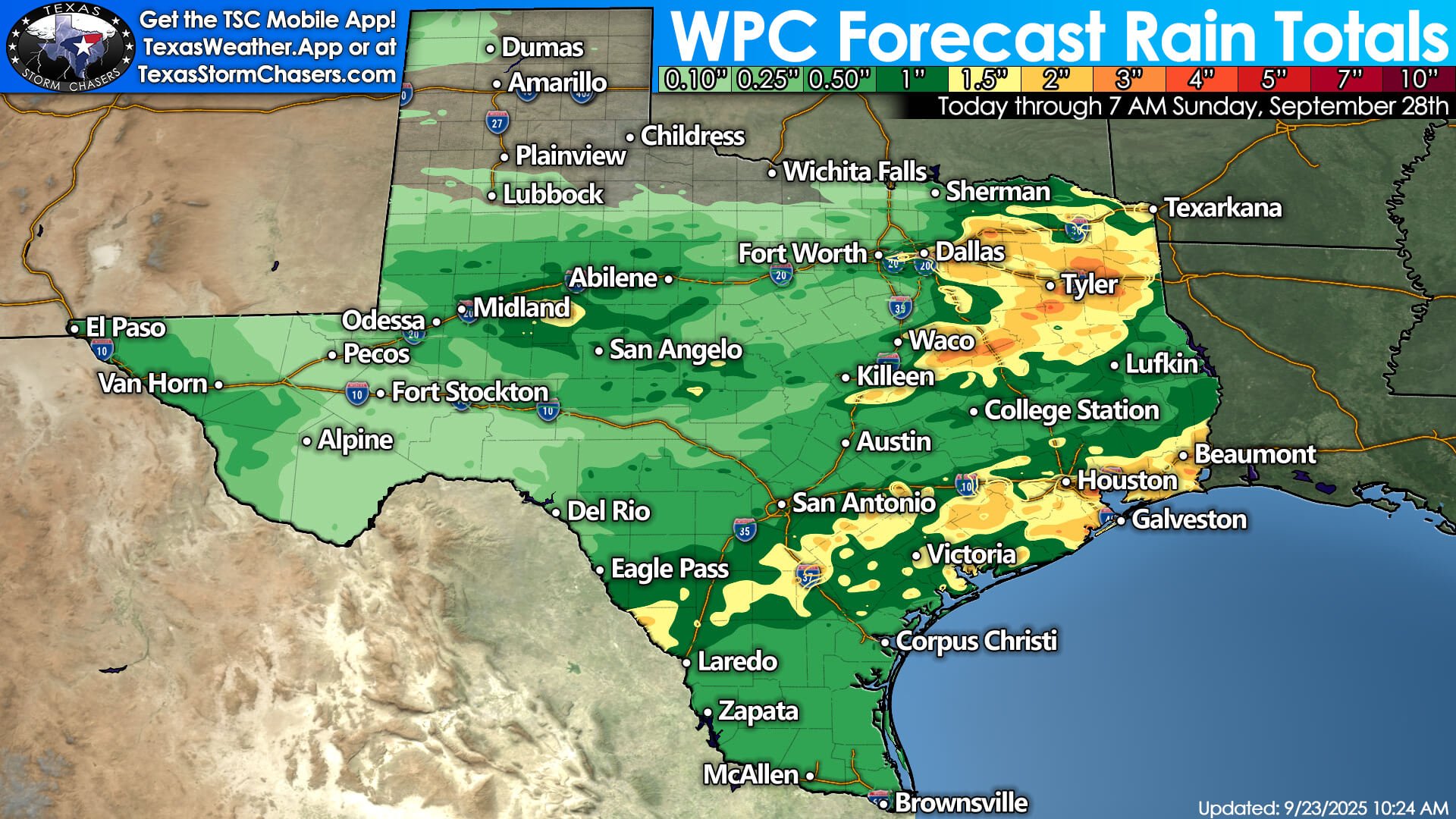
WPC rainfall outlook shows several inches possible in East Texas with locally heavy totals.
Wednesday and Beyond
By Wednesday, the front will slide deeper into the state, bringing storm chances to Central and Southeast Texas, including the Brazos Valley, Hill Country, Houston, and the Golden Triangle. Some storms may be severe with gusty winds and hail, though widespread flash flooding is less likely.
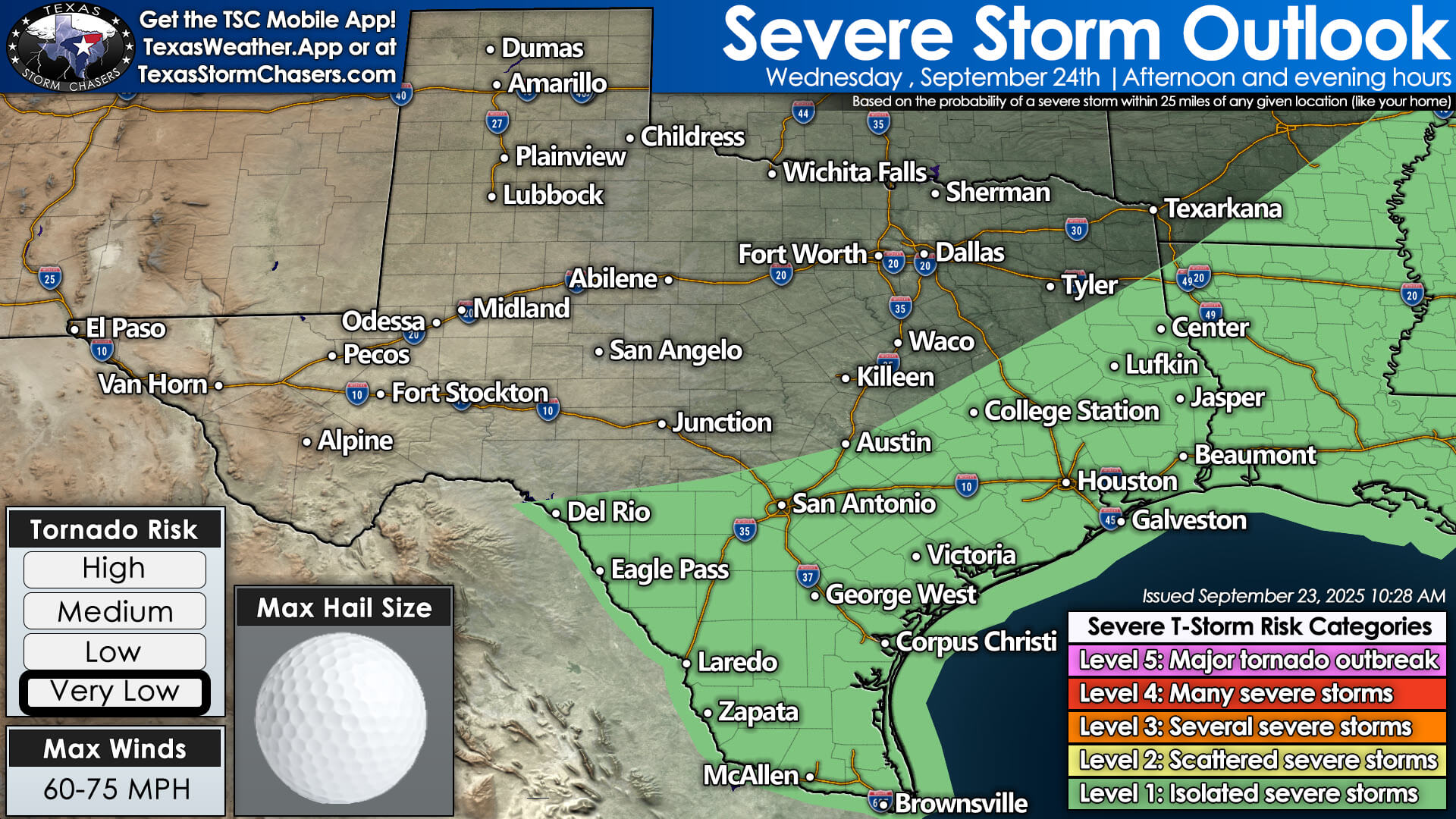
SPC outlook shows isolated severe storm risk shifting south and east Wednesday afternoon and evening.
Behind the front, drier and slightly cooler air filters south. Highs will dip into the 70s and 80s across much of North and West Texas, while the southeast half of the state holds onto 90s for one more day. By Thursday, most of Texas will enjoy lower humidity and more comfortable conditions.
Looking Ahead
Rain chances taper after Thursday for most of the state, with the exception of Far West Texas and the borderland where late-season monsoon moisture lingers. The weekend looks drier and warm, but not extreme, with highs mostly in the 80s to lower 90s.
Stay Weather Aware
Texas Storm Chasers will be watching today’s storms closely. Be prepared for severe weather and flash flooding in your area. You can track the latest storms with our free interactive weather radar on the Texas Storm Chasers website or in the free mobile app.