
Texas is gearing up for another round of active weather on Sunday and Monday as a new storm system moves in from the west. This setup will bring widespread thunderstorms, heavy rainfall, areas of flooding, and the potential for severe storms across several regions of the state. Here’s what to expect based on the latest data.
Storms Develop Sunday Afternoon and Spread Overnight
Storm coverage increases late Sunday morning across the Texas Panhandle, West Texas, the Big Country, and the Permian Basin. Storms then expand northeastward into Northwest Texas, Texoma, and North Texas through Sunday evening and into Monday morning.
Models continue to hint that storms may linger over parts of North Texas and the Dallas–Fort Worth area for several hours Sunday night. If that occurs, rain totals could climb quickly and increase the flooding threat.
Severe Weather Risk Sunday

Sunday afternoon and evening carry a Level 1 out of 5 severe storm risk from the Permian Basin through the Big Country and into parts of North Texas. Threats include:
• Large hail
• Localized damaging winds
• A very low tornado risk
Cities included: Abilene, San Angelo, Midland/Odessa, Fort Stockton, Junction, Eastland, Mineral Wells, and Fort Worth.
Monday: Higher Severe Weather Threat
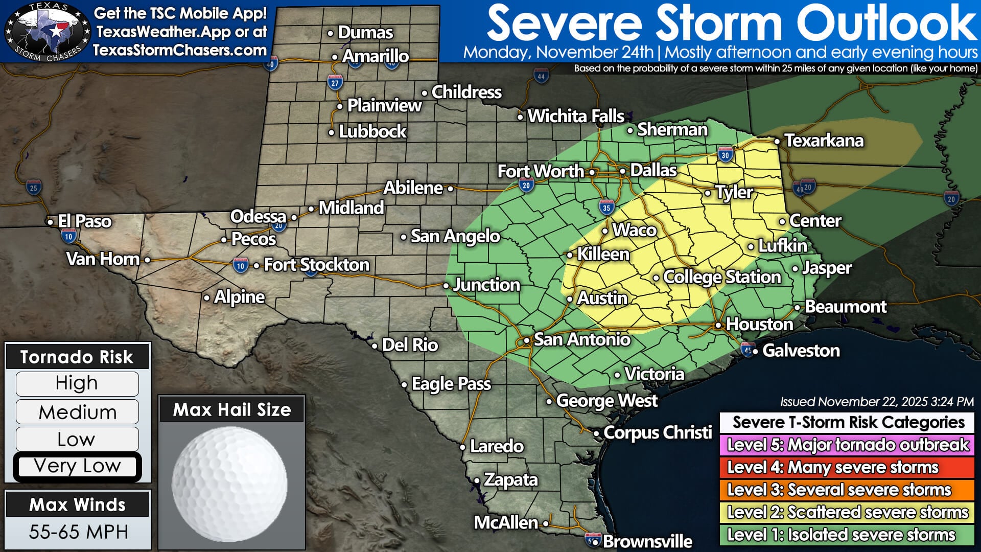
The severe threat shifts east on Monday and intensifies. Central Texas, the Brazos Valley, East Texas, and parts of Southeast Texas are included in a Level 2 out of 5 severe storm risk.
Monday’s risks include:
• Large hail
• Strong to damaging winds
• A few tornadoes possible
This environment will need to be monitored closely as instability and low-level wind shear come together.
Flooding Concerns Sunday into Monday
Flooding remains a significant hazard due to saturated soils and multiple rounds of rain.
Sunday Flash Flood Outlook
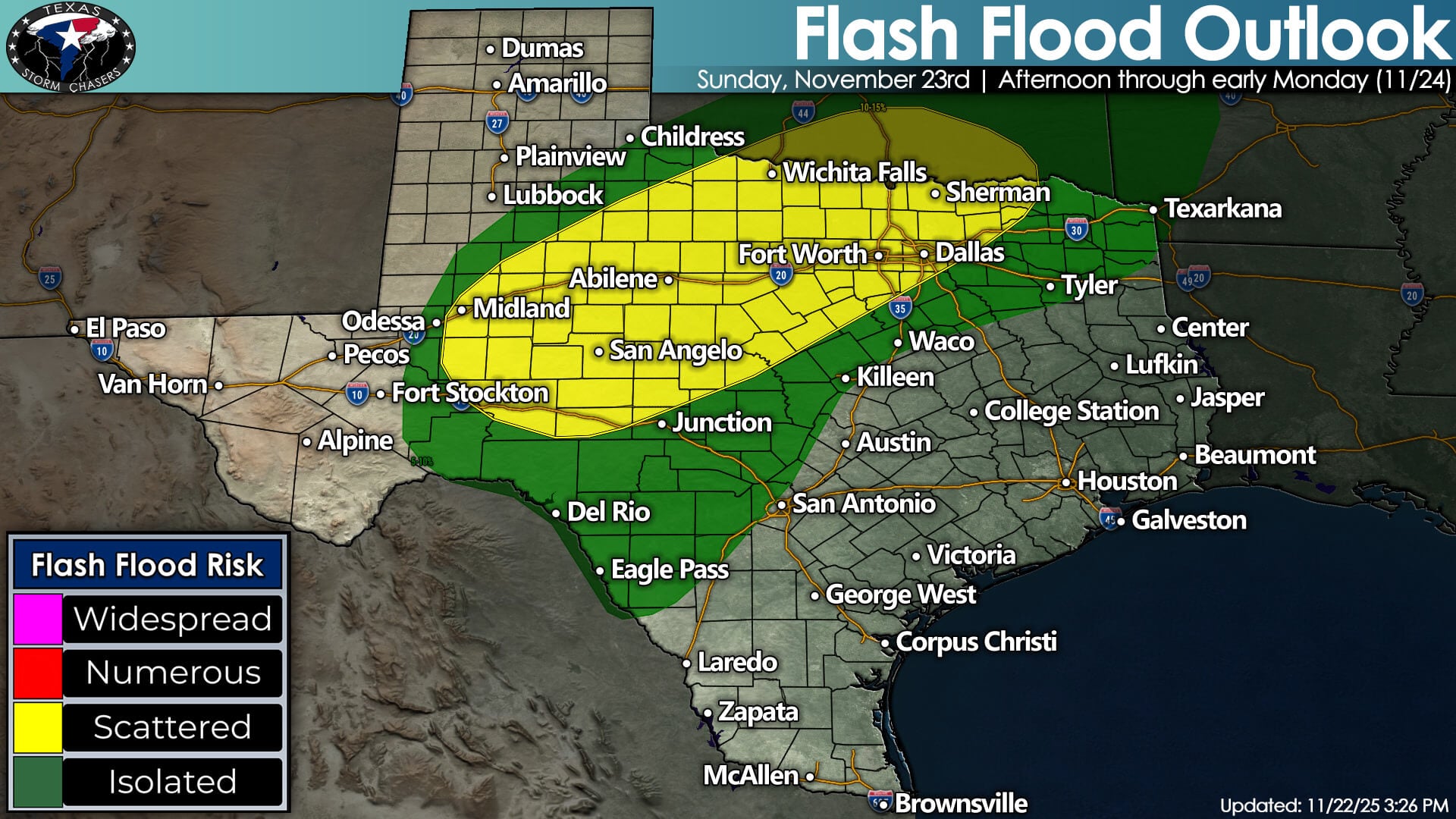
• Concho Valley
• Western Hill Country
• Permian Basin
• Big Country
• Northwest Texas
• North Texas
• Texoma
Cities included: Midland, Odessa, San Angelo, Abilene, Fort Worth, Dallas, Wichita Falls.
Monday Flash Flood Outlook
Flash flooding risk shifts eastward to:
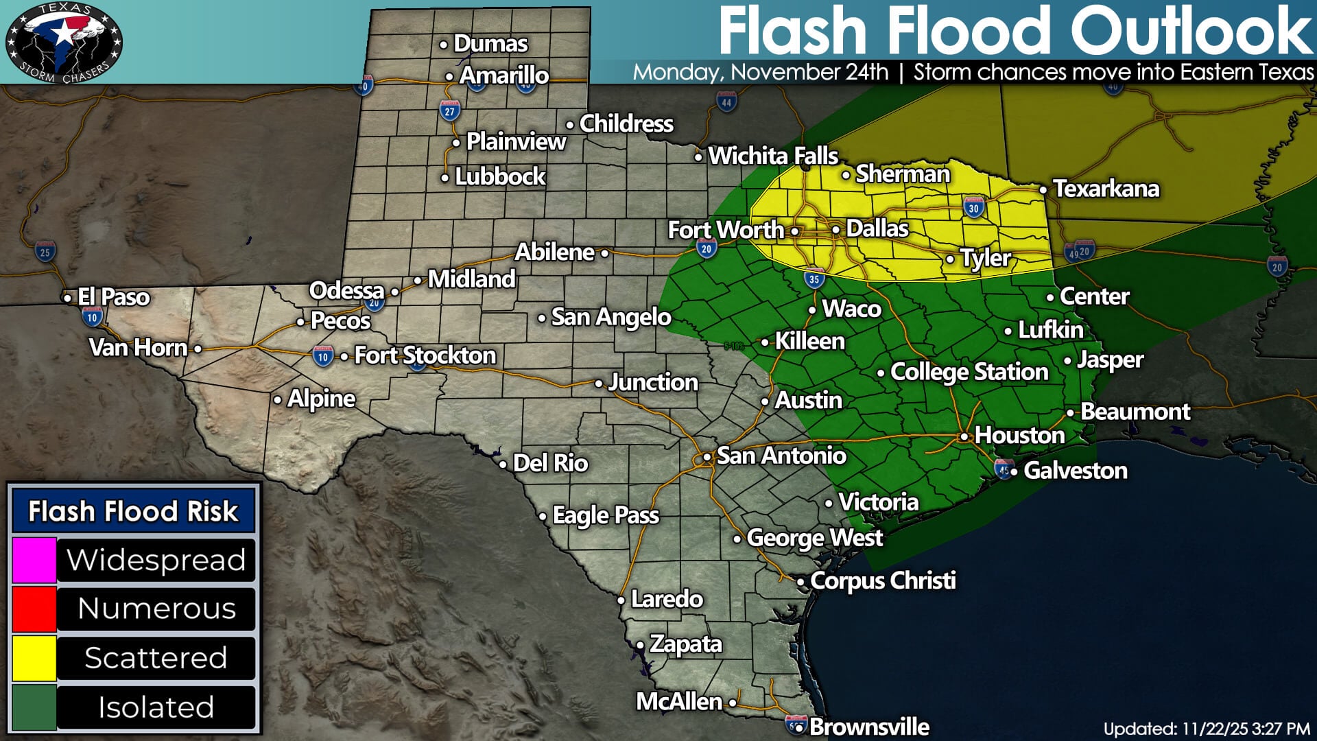
• North Texas
• Texoma
• Northeast Texas
Meanwhile, Southeast Texas and East Texas should see faster-moving storms, keeping the flood threat more isolated.
Rainfall Totals Through Tuesday
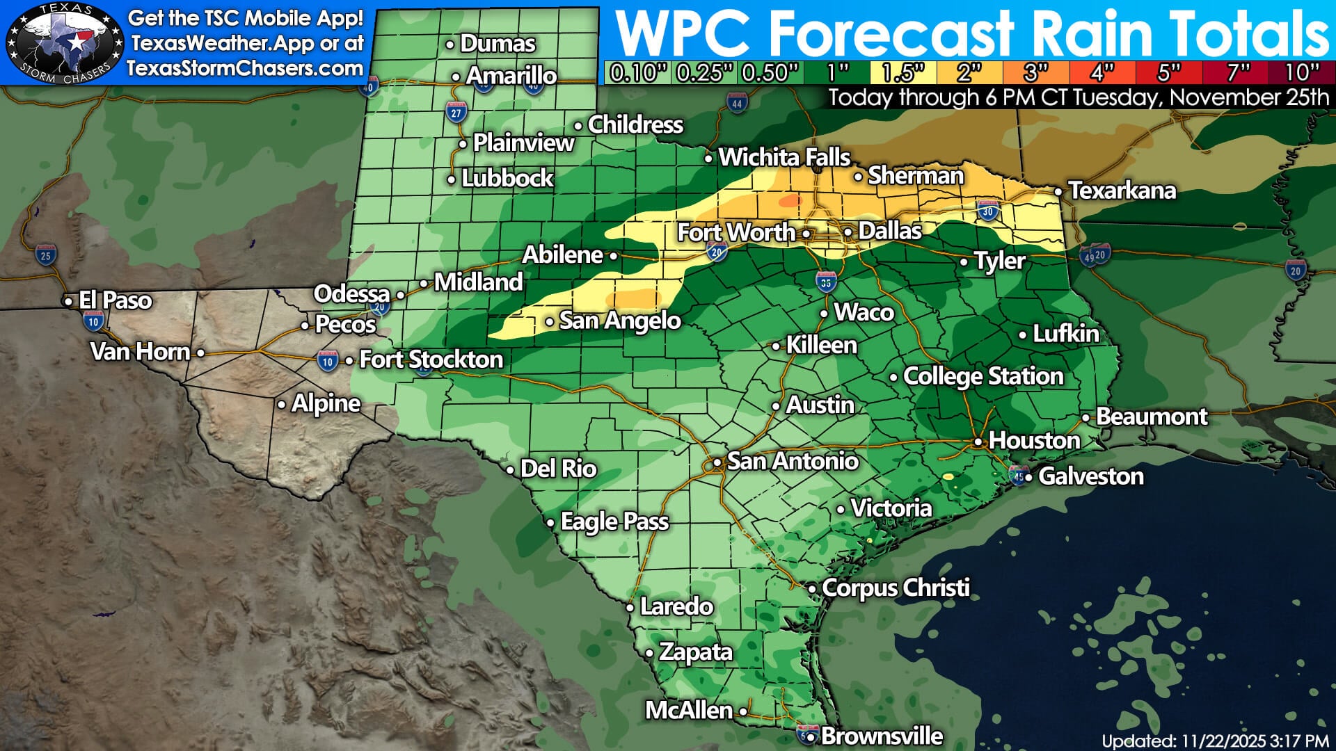
The Weather Prediction Center projects:
• 2 to 3 inches across the Concho Valley, Big Country, North Texas, Texoma, and the Ark-La-Tex
• 0.5 to 1 inch across East Texas, Southeast Texas, Central Texas, and the Hill Country
• Locally higher amounts under slow-moving storms
Given saturated ground from previous systems, expect quick rises on creeks and streams along with periods of street flooding.
What Flash Flooding Means
Flash flooding occurs when intense rainfall overwhelms drainage systems or saturated soils. Impacts may include:
• Rapid rises on creeks, streams, and rivers
• Water flowing across low-lying roads
• Flooding in poor-drainage urban areas
• Unexpected high water in areas that don’t usually flood
Never drive through flooded roads.
Stay Weather Aware Through Monday
Another storm system means another round of heavy rain, flooding, and the potential for severe storms. Be sure to stay updated throughout Sunday and Monday as conditions evolve. Much less active weather will begin on Tuesday and continue through Thanksgiving as a cold front brings a drier, cooler airmass south.
For live severe weather coverage, radar, and local forecasts, the Texas Storm Chasers app is available free on iOS and Android. You can also watch our live stream here on our website.