
A powerful upper-level storm system arrives this afternoon and will bring a messy stretch of weather for parts of Texas over the next 36 to 48 hours. Strong to severe thunderstorms, heavy rain, and areas of flooding are all on the table through tonight and into Monday. Not everyone in Texas will deal with the nastiest weather, but several regions are at risk.
Here’s the latest breakdown.
Storms Increase This Afternoon and Evening
Storms are already ongoing early this morning along the Coastal Plains and Coastal Bend. Additional development begins around 2 PM across the Permian Basin, West Texas, and the Big Country. Those storms will expand and strengthen through late afternoon and evening.
Multiple rounds of thunderstorms are expected tonight from Abilene to DFW, then northeast along I-30 toward Texarkana. This corridor faces the highest flood risk overnight.
Severe Weather Risk Today (Sunday)
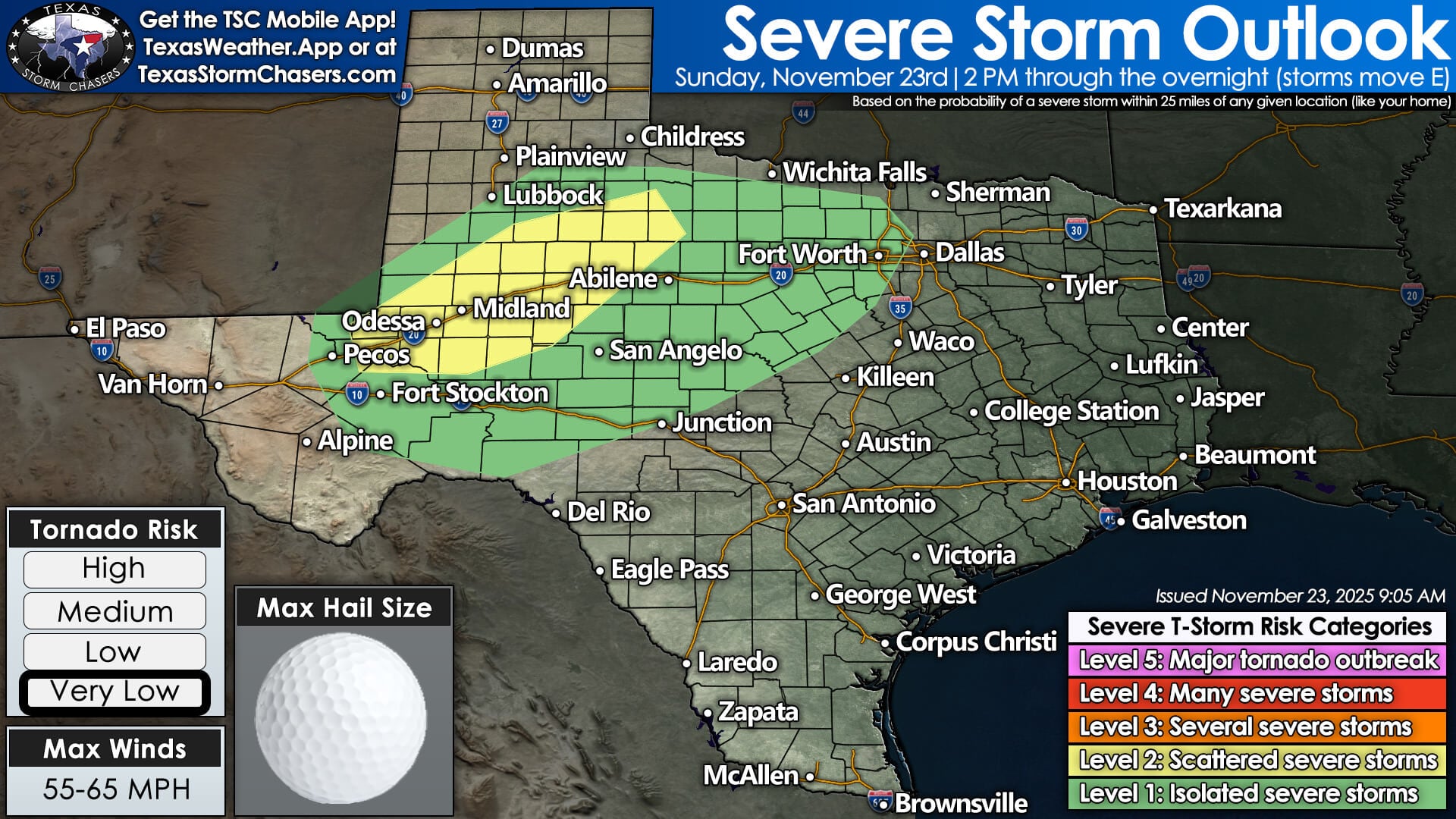
The Storm Prediction Center has upgraded to a Level 2 of 5 risk along the I-20 corridor from near Pecos through Odessa–Midland, Snyder, Sweetwater, Abilene, and into parts of North Texas.
Hazards today and tonight include:
• Golf-ball-size hail
• Localized damaging winds
• Frequent lightning
• A very low tornado risk (not zero, but low)
Isolated severe storms remain possible overnight as activity shifts eastward.
Monday: Higher Severe Weather Risk
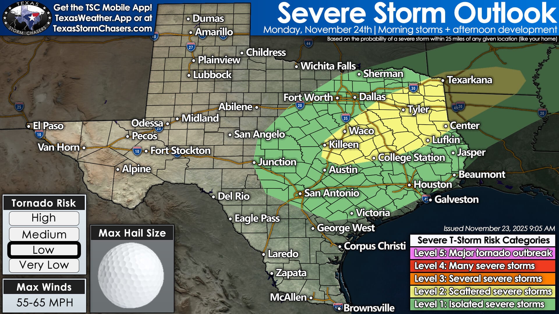
On Monday, the threat shifts east and increases. Areas at greatest risk include:
• Central Texas
• Northern Brazos Valley
• East Texas
• ArkLaTex
A renewed afternoon round of storms may develop over these regions, with potential for large hail, damaging winds, and a few tornadoes. Confidence in how unstable the atmosphere becomes remains moderate, so details will continue to sharpen through the day.
Flooding Concerns Continue Through Tonight and Monday
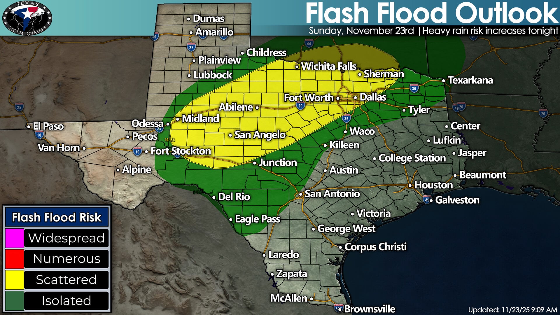
Saturated soils + repeated storm rounds = a real flooding concern.
The greatest flash flooding risk tonight includes:
• Big Country
• Concho Valley
• Northwest Texas
• North Texas
• Texoma

On Monday, the flash flooding threat shifts to:
• Northeast Texas
• North Texas
• East Texas
Storms should move faster Monday afternoon, lessening the flood threat east of I-45, but areas that picked up heavy rain overnight will be at risk early in the day.
Who Avoids the Worst Weather?
Most of the Hill Country, South Central Texas, South Texas, and Edwards Plateau will end up on the quieter, southern side of the system. Isolated storms may occur, but widespread severe weather or significant flooding is not expected south of I-10 and west of I-35.
Clearing Out for Thanksgiving Week
The system exits Monday night.
By Tuesday morning, most of Texas should begin drying out with clearing skies.
A cold front brings breezy northwest winds and cooler, drier air into Wednesday, Thursday, and Thanksgiving Day. Travel conditions mid-week look much improved statewide.