
Despite what the loud corners of social media are shouting, Texas is not heading into an Arctic apocalypse. No “super-duper mega freeze,” no “record-shattering polar vortex,” and nothing remotely close to what’s being circulated in viral posts. What we do have is a normal December cold front this weekend, followed by a quick warm-up next week.
Let’s break down what’s actually happening.
Warm, Quiet Weather Today and Friday
The weather stays calm through the end of the workweek:
• Highs in the 60s and 70s for most of Texas
• No rain through Friday
• Light winds and lots of sunshine
• Areas of dense fog overnight and early morning, especially across:
– Hill Country
– Central Texas
– Coastal Bend
– Southeast Texas
Fog may be locally dense at times, but it will burn off mid-morning.
Weekend Cold Front: Cooler, Breezier, but Not Brutal
A cold front arrives Saturday afternoon into Sunday morning.
Here’s what to expect:
• Temperatures drop into the 40s and 50s across North, Central, and East Texas on Sunday afternoon.
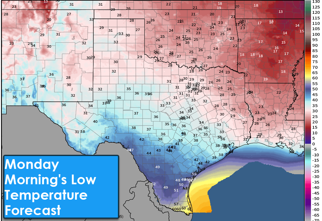
• Breezy north winds behind the front. Low temperatures Monday morning in the 20s and lower 30s in the northern half of Texas and across East Texas. It’ll be cold, but not crazy for December.
• A few spotty showers possible along and east of I-35, but nothing widespread
• South Texas stays warmer, with highs still in the 60s and 70s
This is normal December weather. It is not an abnormally severe Arctic blast for Texas.
A Note on the Social Media Hype
There is an Arctic air mass hitting the Midwest, Great Lakes, and Northeast.
That is true.
But it is not coming to Texas.
Any posts claiming otherwise are misinterpreting long-range model noise, cherry-picking data, or—let’s be honest—trying to farm engagement. Here in Texas, we get cooler weather Sunday, then we warm right back up.
Looking Ahead: Warm Pattern Returns
After the weekend cooldown:
• Temperatures rebound statewide
• 60s, 70s, and even some 80s return next week
• No major storm systems for several days
• Long-range outlook favors a warmer-than-average Christmas
Yes—right now Christmas looks warm. No snowmen melting in the driveway because they never existed in the first place.
Rain Chances Next Week
Our next legitimate chance for some rain shows up Tuesday and Wednesday:
• Hill Country
• South Texas
• Rio Grande Valley
• Coastal Plain
• Southeast Texas
• East Texas
This doesn’t look like a soaking rain event, but it’ll be the first chance in quite a while for anything measurable.
Fire Weather Concerns Growing
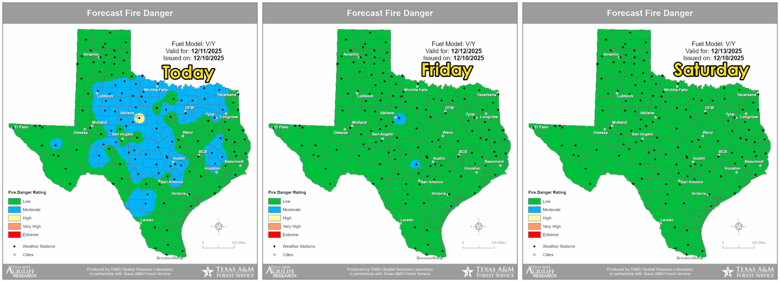
Even with recent moisture, dormant winter grasses are drying out again.
The Texas A&M Forest Service shows low to moderate fire danger statewide today, but the trend is upward as temperatures warm and humidity drops.
We’ll continue monitoring this as we move deeper into a dry stretch of December.
Final Thoughts
Today and Friday: Warm, quiet, calm.
Saturday–Sunday: Cold front, breezy, cooler—but normal.
Next week: Warm again, some rain chances mid-week.
Christmas: Likely warm.
Texas isn’t diving into an Arctic deep freeze, and there’s no reason to panic. We’ll keep giving you the straight story, hype-free.
For your local forecast, interactive radar, and 24/7 live weather stream, visit TexasStormChasers.com/live or download the free Texas Storm Chasers mobile app.
Stay informed, stay sane, and enjoy the warm weather while it lasts… and departs for two days.