A weak, cool front is moving through the Texas Panhandle this morning. Gusty north winds and slightly cooler weather are expected behind the front. The cool front will push through the northwestern third to half of Texas today. High temperatures will only reach the mid-70s in the Panhandle today, with 80s across the northwest half of the state. Everyone else will experience another hot afternoon with temperatures reaching the 90s. The front does not deserve, nor shall it receive, the grace of being named ‘Crashy the Cold Front.’ No rain is expected, and it will be mostly sunny across Texas today.
Any cool-down will be brief, with temperatures rising back into the 80s and 90s statewide on Wednesday and for the remainder of the week. Humidity levels aren’t bad, so temperatures have been able to cool off decently at night. We’ll see that change by the weekend in the southeastern portions of Texas.
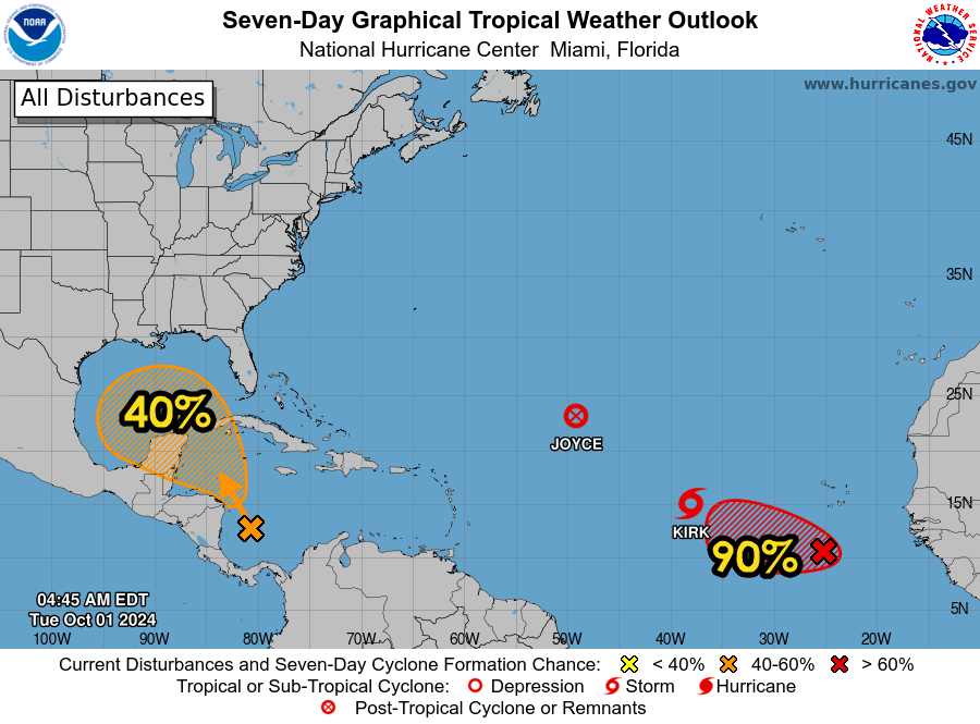
A tropical disturbance in the Caribbean will slowly move north into the Gulf of Mexico by this weekend. The system has a medium chance of developing into a tropical cyclone. Most long-range weather model data has the system moving east of Texas. We’ll keep an eye on it, though, as it may still bring rough surf and perhaps a few showers to the state early next week.